A prescribed burn undertaken in West Cape Howe National Park in late May by the Department of Biodiversity, Conservation and Attractions (DBCA) has been praised by conservationists.
WA Forest Alliance (WAFA) is part of a growing movement concerned with how fire is managed in the Southwest and its impact on fire and smoke on native plants and animals and human health, as well as the risk of escaped prescribed burns. Yet the recent burn on WA’s Southcoast is being hailed as an example for ecologically appropriate burns.
West Cape Howe National Park is beautiful Country, with towering cliffs, white sandy beaches, granite headlands, huge crashing waves, coastal heathland and even some Karri forest. It’s located right on the southernmost tip of WA, and is home to stunning wildlife, like Honey Possums, critically endangered Western Ringtail Possums and the ancient Mains Assassin Spider.
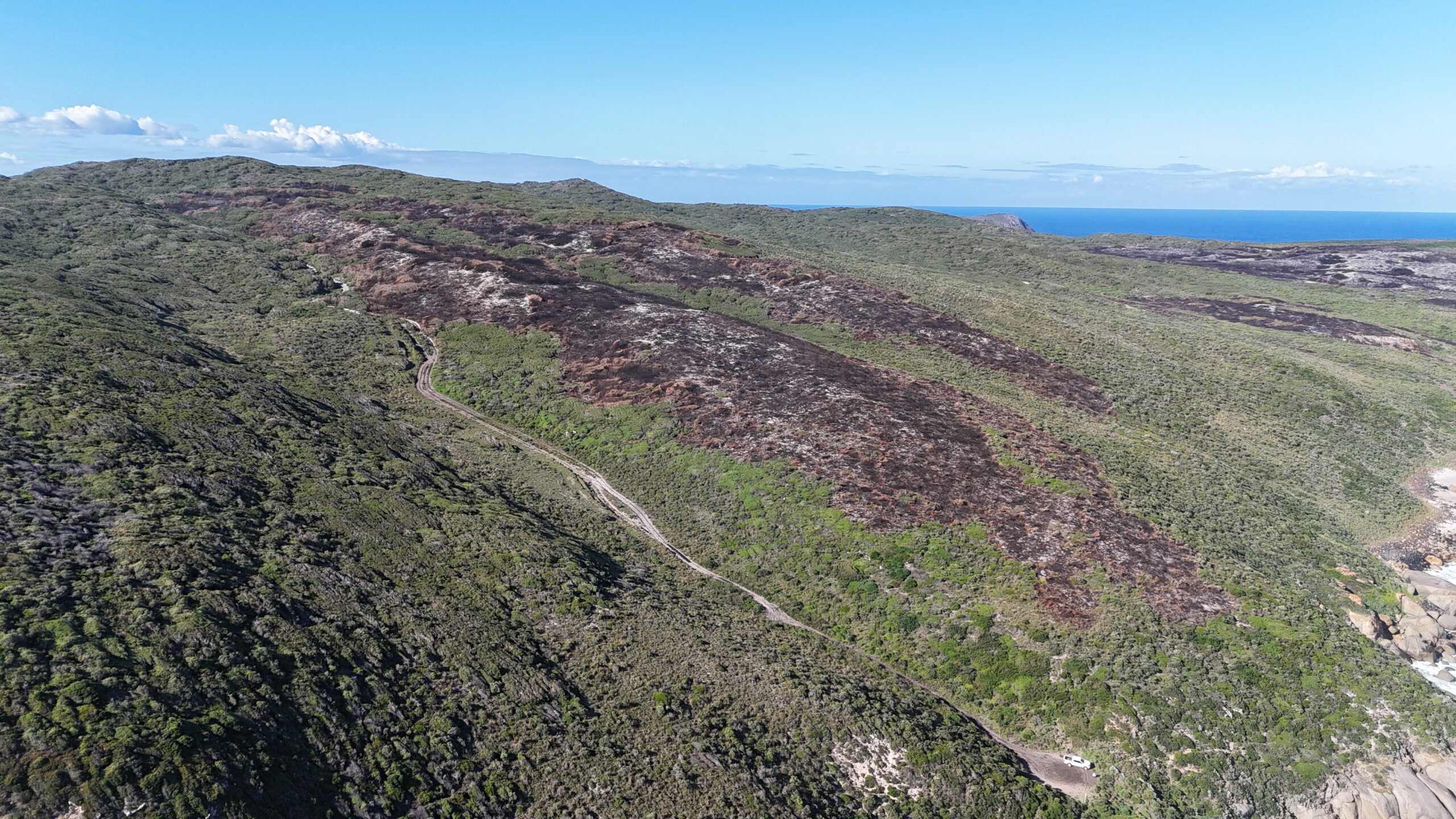
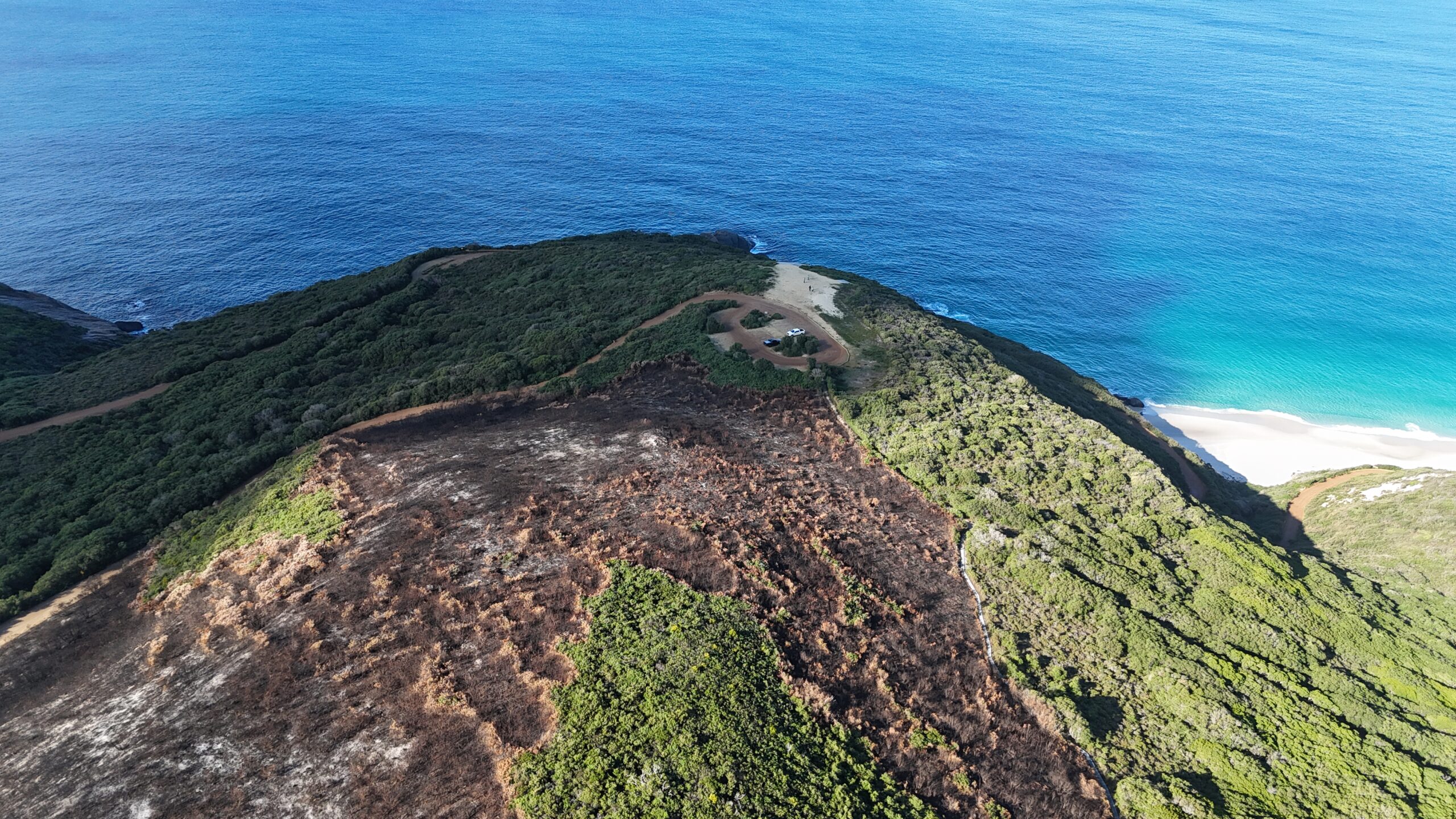
Part of this burn’s success can be attributed to ideal conditions, being lit at the end of May, on a day with light winds and after three months of good rains. This resulted in a gentle, slow moving burn that balanced ecological values with fire prevention.
The burn also avoided popular tourist destination Shelley Beach, and areas surrounding the Bibbulmun Track were minimally burnt at a low intensity to preserve the experience for walkers.”
WAFA’s Senior Campaigner Jason Fowler, praised the approach, stating, “The burn was ignited at the right time in the right conditions, with a focus on biodiversity and a plan to achieve good outcomes for wildlife. Light winds and a moist landscape meant the prescribed burn was slow moving and did not burn out the lower valleys, allowing wildlife time to find refuge from the fire.” Fowler urged that “DBCA fire managers should use the West Cape Howe prescribed burn as a model of how to get it right when burning coastal ecosystems and not repeat the destructive burns seen further west at the Quarram Nature Reserve and Bellanger Beach.”
Local botanist Dr Joanna Young, after visiting the park, remarked, “This prescribed burn created a genuine patchwork of burnt and unburnt areas, supporting a diversity of growth stages.” She added, “Many Banksia and Hakea species thrive after fire, so this burn is likely to produce overall biodiversity gains for West Cape Howe National Park.”
Dr Young also noted the importance of managing Peppermint thickets, as these can dominate and crowd out other species if left unchecked. “DBCA needs to adapt their burning programs to deliver more results like this, rather than the widespread blackened landscapes I’ve seen from burns conducted in summer—many of which cause damage similar to the wildfires they aim to prevent.”
She concluded, “The goal isn’t to halt prescribed burning altogether, but to carry it out with far greater sensitivity to the conservation values of our parks.”
This burn is an ideal outcome, providing net gains for biodiversity and fire protection. DBCA should look at this like a blueprint for future burns, and look to alternate strategies for fire prevention, including rapid detection and suppression. We are glad to see that DBCA will soon be trialling AI smoke detecting cameras across the Southwest and we look forward to seeing more appropriate burns in the future.